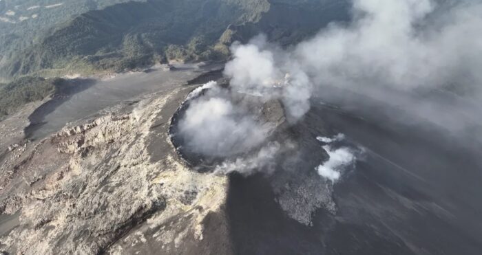

Guatemala has raised alarms following a sudden and violent increase in activity at the Volcán de Fuego, one of Central America’s most active stratovolcanes. The volcano has entered an intense phase of paroxysm, maintaining a continuous emission of gases, lava, and dense columns of ash reaching up to 7,000 meters high, alongside dangerous pyroclastic flows.
This intense eruption has triggered safety protocols and evacuations within a 10-kilometer radius in Guatemala. However, the event has also drawn concern across the border in Mexico due to geographic proximity. Located in central Guatemala between the departments of Sacatepéquez, Escuintla, and Chimaltenango, the volcano sits roughly 140 kilometers in a straight line from the southern Mexican state of Chiapas.
While lava flows and pyroclastic surges pose no direct threat to Mexican territory given the distance, the dispersion of volcanic ash is a concrete possibility for Chiapas’s border region. According to monitoring data and ash-dissemination maps from Guatemala’s INSIVUMEH, winds and large eruption magnitudes can carry fine particles across the border. Specifically, the municipality of Tuxtla Chico is currently within the potential radar zone for ash fallout as winds drive debris toward the neighboring department of San Marcos.
Although neither federal nor state authorities in Mexico have issued an official emergency alert for the region, residents in the border zone have been advised to remain vigilant and follow updates exclusively through official channels as the volcanic crisis in Central America continues to evolve.
Source: https://www.sinembargo.mx